
My first look at the Al-Khazneh, the Treasury.
Petra. I was doing a great finishing this blog until I got to Petra. Words defy it. Sorting through the 400 incredible pictures I took over two days was just too much of a task. Doing a year's worth of updates on the En Sabah Nur ultimate website didn't help either, but that came when I needed a break from sorting photos anyway.

This view shows almost all of Petra. At the bottom is the Street of Facades. Just beyond the end of the photo to the left, is the Treasury. On the middle left, is the High Place of Sacrifice. On the right side of the photo is the Colonnaded Street. Off the photo to the top right is the Al Deir monastery.
Betty and I got dropped at a hostel that her friend recommended to us. The hotel host gave another that was three times what we had expected it to cost based on experience and the guide book. I just turned around and walked out. I was not in the mood to be negotiating anymore or to deal with people who I felt were trying to rip me off. The host followed me back to the van and wouldn't let us close the door for a minute while he tried to convince us to stay. We left and went to the hotel that the other guy in the taxi was going to. It was cheap. They didn't try to overcharge us. I was happy.

A close up of the decoration of Al Deir monastery.
As soon as we dropped our gear, we were off to the ruins of Petra. It costs a fortune to get in. It is 50 dinars for one day if you were staying local, 55 for two days, and 90 if you were just coming in for a one day tour and not sleeping in the city, like off a cruise ship. 90 Dinar is 127 United States dollars. We didn't have enough money and they don't accept credit card. There is a hotel near the entrance that has an ATM, but it was broken. We had to walk the 2km back up hill to town to get money. However, just after we got started a guy let us ride in his truck bed that still had sheep scat in it. On our second trip down to the ruins, we finally got our two day pass to get in.

Rose red coloring.
Petra is an ancient Nabatean city from the 6th century BC. It is commonly called the Rose Red city in reference to the colors of the rocks. The Nabateans controlled the land and oases from the Euphrates in eastern Syria to the Red Sea in Saudi Arabia. They were powerful traders, but Rome annexed them in 106AD. All they have left behind is pottery and tomb sites, the most famous of which is Petra.

A Bedouin salesman, perhaps the ancestor of one of those traders.
Unfortunately, Petra was destroyed by an earthquake in the 6th century AD and was abandoned. Then, it was forgotten about by the Western world when Saladin conquered the entire Middle East in the 1100s. I've mentioned him a lot in my blogs because he was the one who laid siege to and defeated so many Crusader strongholds. It was not rediscovered until 1812 when the Swiss explorer, Johann Ludwig Burckhardt, explore the area in disguise. He had to pretend to be an Arab scholar because the Bedouin were not the most welcoming to outsiders at the time. Even though Western scholars rediscovered the site in 1812, I think that the general public and pop culture did not rediscover Petra until it was used in Indiana Jones and the Last Crusade.

This tomb was a rare exception because it had carvings on the inside. Most did not.
After a short walk down a dusty path, we got to the entrance of As-Siq, the canyon that leads to the most famous landmark in Petra, the Treasury. The trail looked crowded and we had two days to explore so on a whim, we turned off for the Wadi Muthlim trail. It didn't have any of the major sites along it, but would end near some.

Wadi Muthlim.
When we tried to confirm the starting point of the trail, the police didn't want to let us go. They said you it was too dangerous. I was over hearing this subjective line being repeated and said thanks and went to leave. The police continued. He said they had a camera and that the headquarters might call them to have them stop me. He said we should take a guide because it was dangerous. We left because the sign said that guides were recommended, but not required.

Crazy color patterns in Wadi Muthlim.
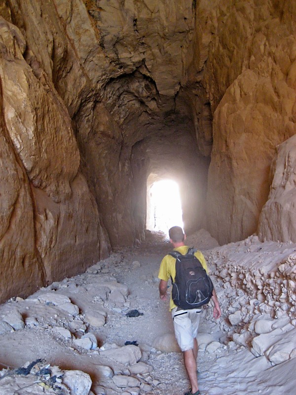
The tunnel you are supposed to enter for the Wadi Muthlim trail (photo by B. Cremmins).
A guide would have been helpful for the start of the trail. You are supposed to drop into a canyon and go through a tunnel that the Nabateans built. We didn't realize this and walked above the canyon looking in. Eventually, we got stuck or just realized that we had to be in the canyon. I can't remember. We tried to climb down, but it was a little sketchy. We just went back to near where the police were and discreetly walked down. No one, police or guide in waiting, bothered us.

The valley that Wadi Muthlim opened up on.
The canyon was as dry. It was the end of summer and it has not seen water in months. However, there was a ton of stuff to show that water had been there. You could see that garbage had gathered in one spot. You could also see the rock worn away in patterns that matched the waters' current. It was gorgeous. We thought that canyon was only going to be geological wonder because there was nothing on our map, but Betty spotted some carvings. They were pretty cool. Hiking the canyon was a bit of work. I don't think it has been modified. You need to climb up some rocks and down some boulders. Your ankles better be strong because you are never walking on even ground. It was a great hike that dropped us in a valley where we had lunch.

A donkey rider heading up the valley.
While we ate lunch, we interacted with a Bedouin man. He was mute, but we were still able to communicate a little bit. I have no idea where he lives or what he does, but I know he is good at finding quiet spots to soak up amazing views. It was brilliant to come out of the canyon on to the open valley. It was sand stone colored instead of the rose red, but that provided a great contrast. There were a bunch of tombs that no one visits up there either. One of them used to rival the treasury, but has eroded over the years. We practically had the place to ourselves.

Tomb 646 used to rival the treasury until erosion got a hold of it.

A Bedouin man who shared his tea with us.
On our way down the valley to the Royal Tombs and the main tourist path, we were waved over by a Bedouin man in a cave. He wasn't selling anything. He was also just enjoying a quiet spot. He said the only tourists he usually saw in that area were the ones sneaking into the sight from the village above. He offered us some of his tea. Betty got a mini metal mug. I got a half a tin can. We both got a cup of sugary goodness. Bedouin might be sweeter than Southern sweet tea. I know his might be blasphemy, but it might be true. Sweet tea has always good. Sometimes the Bedouin tea was too sweet.

The Palace Tomb is called that because it looks like a palace. It wasn't one, but it is one of the Royal Tombs.
When we reached the Royal Tombs, we still didn't get on the main road. We climbed Jabal al-Khubtha mountain. From the top, we got a great look at the entire area. Also at the top, was a Bedouin vendor. I can't remember if he was selling water, food, rocks, or trinkets, but I was amazed he was up there. It wasn't the hardest ascent, but we didn't see that many people up there to buy stuff. Maybe he was just cornering a small part of the market.

Sextius Florentinus' tomb. He was the Roman governor of Arabia. The tomb was carved around 128AD.

Urn Tomb, the largest Royal Tomb at 17m x 18.9m.
When we finally came down the mountain, we were in for a treat. The sun was shining a golden color on the the Royal tombs. We explored each of them. Most of the exploration and amazement is done from the outside. On the inside, they are almost all just empty square rooms. Lots of the ruins have names, but they aren't those things. The Treasury was not a treasury. The Palace Tomb was not a palace. They were just tombs. As far as we read and could tell, every ruin was a tomb. I've read this was a full city, but I'm guessing that all the other buildings were destroyed. It is similar to mos ruin sites, I guess. The regular buildings don't survive the test of time. The only exception I can think of is Pompei where everything was buried in ash. I'm sure there are others. Anyway, we took a seat and watched the golden hour light illuminate the tombs and a donkey get loose and run from its owners. They work the animals hard and I cheered the donkey on during his escape.

Me beside Urn Tomb, the largest Royal Tomb (photo by B. Cremmins).

Royal Tombs and part of the Street of Facades.
On our way out, we passed the huge theater and the Street of Facades. Then, we turned off for the Siq. We walked right past the Treasury, but I made a special point not to check it out. I wanted to make sure I had a surprise for the next day. When we got back to the hotel, we were in for a treat, Betty's bike had arrived. I was really excited to getting riding again. However, first we had one more amazing day in Petra.

The Siq Trail leading to the Treasury. Watch your step because the carts might run you down.

The eroded remains of a statue soldier. This might be my favorite carving in Petra.

A closer view of the Treasury from the Siq.
We got up early to try and get to the site at 6am when it opened. However, the breakfast we were promised would be ready, wasn't. We had to wake a guy up, who went to buy bread, and then they sent us on our way. We got to the Treasury around 6:40am, I think. We were almost alone. There were two camels and a guy offering camel rides. After we said no, he politely left us alone. Over the next hour, about ten other people joined us. It was peaceful. It was special. It will be one of the most memorable moments of my trip.

Two perfectly placed camels in front of the treasury for your riding pleasure.
Walking through the Siq to the Treasury.

I think this dog was guiding us through the Siq in hopes of getting a treat (photo by B. Cremmins).
The sun had risen, but the sunlight was not on the Treasury yet. I was hoping to take some photos with the treasury illuminated, but the sun was not getting there any time soon. We waited. Got bored. Walked. Came back. Waited some more. Repeat. Around 9:00 am the sun finally hit the top of the treasury. Unfortunately, in the three hours we dilly-dallied, the crowds had arrived. It wasn't nearly as pleasant so instead of tainting our wonderful experience from the morning, we just left.

The view from the High Place of Sacrifice.
Today's plan was to head up to the High Place of Sacrifice. It was another big hike that took us away from the main path. The High Place of Sacrifice wasn't the best ruins, but it provided great views of another valley that we were going to descend into. Along the way to that valley, we saw stray dogs that pulled at my heart strings and a few ruins.

I find food to feed a stray dog (photo by B. Cremmins).

Another stray dog that suckered me into feeding or watering it.

The Lion Fountain looks a little bit like an elephant to me. He is standing on all fours. The tail end is on the left.

The Garden Temple Complex used to have a garden in front of it. I imagine that when the Lion fountain lost its water source, so did the garden.
The lion fountain was an illusive ruin. We looked at for a few minutes and could not figure out where the shape of the lion was. Finally, a Bedouin woman showed us where it was. I wish the earthquake had not destroyed all their water infrastructure because I can't imagine how they got water up to it. They probably didn't it the same way we do it today, but I don't know how we do it today either. I know the Romans had running water in 100AD and the Nabateans were famous for their water engineering in 600BC, but at what level was their technology? At the entrance to the Siq, they had built a dam and a tunnel, that we had hiked through the day before, to control flash floods and their water supply.

I think this was the Roman Soldier's Tomb.
After dropping into the valley and exploring another dried up wadi, we got back to the main tourist road. We stopped to eat at an overpriced lunch buffet that I tried to make pay for itself by eating a lot. Since I couldn't quite do the task alone, I grabbed some meat to feed to the stray dogs and cats. They were very happy and greedy. One kitten at the Treasury stole the chicken wing from its mother who had been nursing it.

Another almost empty wadi.
Our last big site in Petra was Ad-Deir Monastary which was probably a tomb, but may have also been a temple. You have to climb 800 steps up to the monastary. Some people take a camel. It was amazing to see just how many people were willing to make the hike up. When I got there, I understood why. The monastery is amazing. It was built the same way as all the other tombs, but it was bigger and the views around it were amazing.

Al Deir monastery.
Just beyond the monastery, some businesses have taken up a marketing campaign to get you to visit. One Bedouin stall was marketed as the Best View in Petra. Another was the Last View in Petra. Another was the most beautiful and they all had a bunch of signs. It was funny. They all had great views. I would have trouble saying that any single one was much better than the other.

Me in the doorway to the monastery. It was huge!!
Eventually, we wound our way down from the monastery and home. We had spent two very full days in Petra, but I suspect we could have spent more. We had covered all the major sites, but there was at least one more mountain to climb and who knows how many hidden tombs among the winding wadis. Even as I was writing this, I am realizing a coupe more nooks to go back and explore.

The capital of Jordan, Amman, used to be called Philadelphia.

No comments:
Post a Comment